Flood Planning
Flood Map Heading link

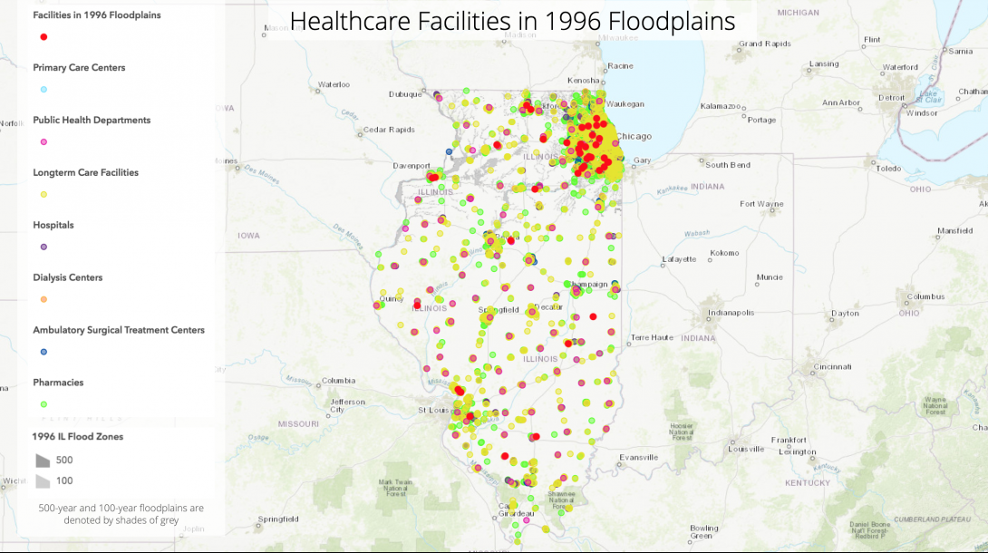
Floods are the most common natural disaster in Illinois, accounting for well over 90% of all declared disasters. Urban flooding has caused at least $2.319 billion in damages between 2007 and 2014. Climate change is causing Illinois to get significantly more rain now than it did 50 years ago leading to an increased risk of waterborne diseases, respiratory health illnesses, mental health distress, injuries, and fatalities. Local government entities, long-term care facilities, and hospitals play critical roles in climate preparedness, particularly in the development of preparedness plans for floods. BRACE-Illinois developed a map to identify healthcare facilities in or near floodplains as a tool for flood preparedness planning. The healthcare facilities mapped include public health departments, hospitals, primary care facilities, long-term care facilities, pharmacies, dialysis centers, and ambulatory surgical treatment centers. You can find your county and city to see which healthcare facilities are in your area and which ones are in or near a floodplain.